Friday, Aug. 26 & Saturday, Aug. 27 Outlook
No waivers as of 9:15a ET, though wouldn't be surprised to see another batch covering NYC on Friday
Welcome to any new readers! And as a reminder to long-ish time readers, we’re testing a new format for these outlooks. To both old and new—we’re grateful you’re here.
If you have questions about the content of this outlook, the answers might be in this post(we keep adding to it). Otherwise, let us know if something doesn’t make sense (we welcome feedback of all kinds!).
Friday, August 26
We forecast TSA will screen 2.275 million travelers (± 0.5σ, or a prediction interval of about 38%, is 2.21-2.34 million travelers).
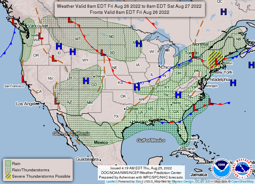
A weak frontal system will begin to impact the Northeast area by afternoon. While the most favorable setup for convection looks to be across New England, ample surface heating and low-level moisture may allow for a few strong to severe thunderstorms around NYC.
The slow-moving system that has brought heavy rains to the Gulf/Southeast will become less organized.
Saturday, August 27
We forecast TSA will screen 2.024 million travelers (± 0.5σ, or a prediction interval of about 38%, is 1.96-2.109 million travelers).
Monsoonal showers and thunderstorms continue for the Four Corners region; with a bit more granularity, coverage looks better for the mountains than the urban corridor (including DEN).
You can check out1 hourly estimates in this workbook.
While it links to a Google Sheet, it’s an Excel file and relies on the XLOOKUP function, which does not exist in Sheets. You can download the file and open in Excel, which should resolve the #NAME? error; if any readers don’t have Excel, let us know and we can work on a solution.


