


Saturday, Sep. 17 & Sunday, Sep. 18 Outlook
Latest LAX TAF is in hand for Dorkfest tomorrow; watching severe thunderstorm threat around Chicago late Sunday

Welcome to any new readers! And as a reminder to long-ish time readers, we’re testing a new format for these outlooks. To both old and new—we’re grateful you’re here.
If you have questions about the content of this outlook, the answers might be in this post (we keep adding to it). Otherwise, let us know if something doesn’t make sense (we welcome feedback of all kinds!).
Saturday, September 17
We forecast TSA will screen 1.929 million travelers (± 0.5σ, or a prediction interval of about 38%, is 1.87-1.99 million travelers).

Publishing a bit later than normal today as we waited for a LAX TAF that covers Dorkfest. Ahead of a storm system digging southeast from the Gulf of Alaska, a maritime influence becomes more apparent: low clouds fill-in overnight, with an overcast deck around 1,500’ forecast by tomorrow morning. Thankfully, 17Z TAF calls for clouds to scatter and bases to lift to 2,500’ by 10 a.m. Pacific. Just in time for Dorkfest.
Elsewhere, a ridge of high pressure strengthening over the Central US will discourage showers and thunderstorms from spreading as far south as DEN. Similarly, DFW looks to dodge the bulk of any convection.
American, Delta and United all have a waiver out that covers the Caribbean as it relates to Tropical Storm Fiona.
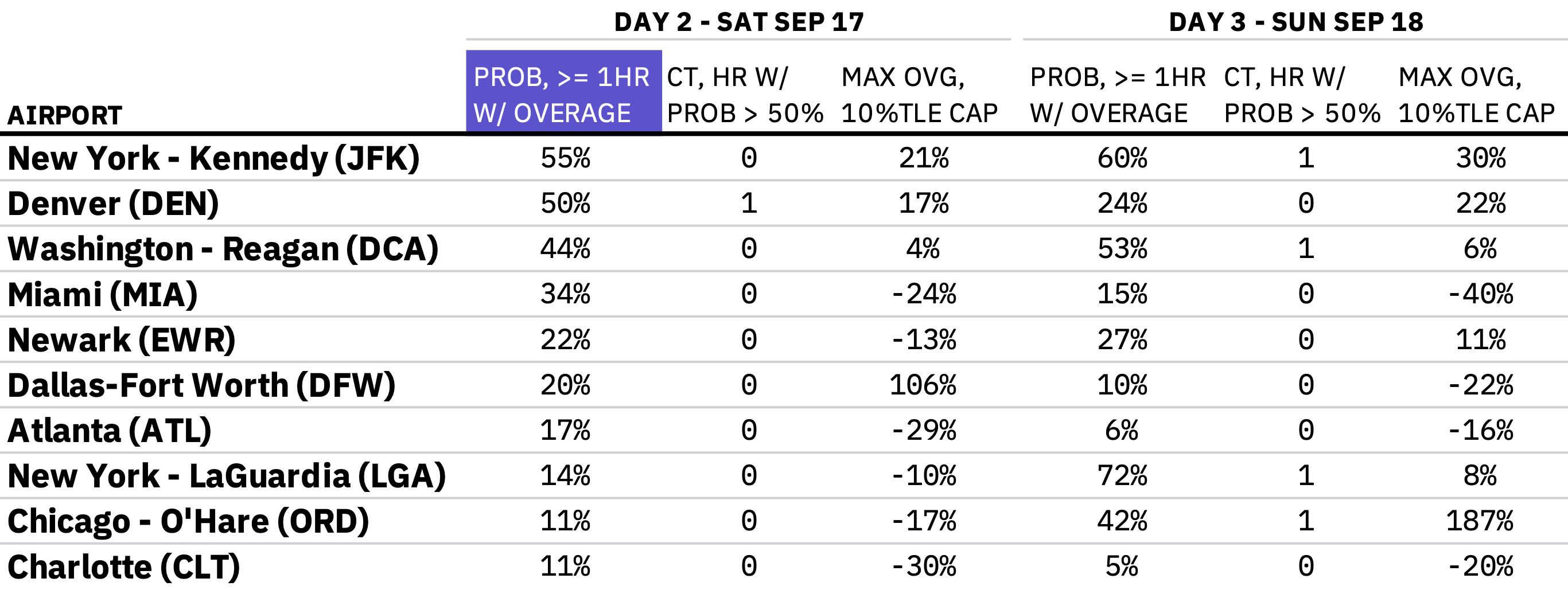
Sunday, September 18
We forecast TSA will screen 2.264 million travelers (± 0.5σ, or a prediction interval of about 38%, is 2.20-2.33 million travelers).
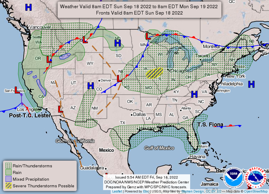
Convection should trigger somewhere in central Iowa to the southern Wisconsin/northern Illinois region after peak heating. Semi-organized to possibly well-organized thunderstorms are favored around ORD during evening and early overnight.
High pressure moves offshore of NYC Saturday night into Sunday, though a cold front doesn’t sink sufficiently southward as to introduce shower chances until Monday.
You can check out1 hourly estimates in this workbook.
While it links to a Google Sheet, it’s an Excel file and relies on the XLOOKUP function, which does not exist in Sheets. You can download the file and open in Excel, which should resolve the #NAME? error; if any readers don’t have Excel, let us know and we can work on a solution.