Tuesday, Sep. 13 & Wednesday, Sep. 14 Outlook
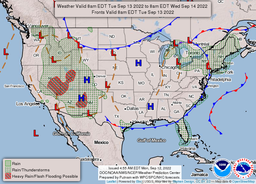
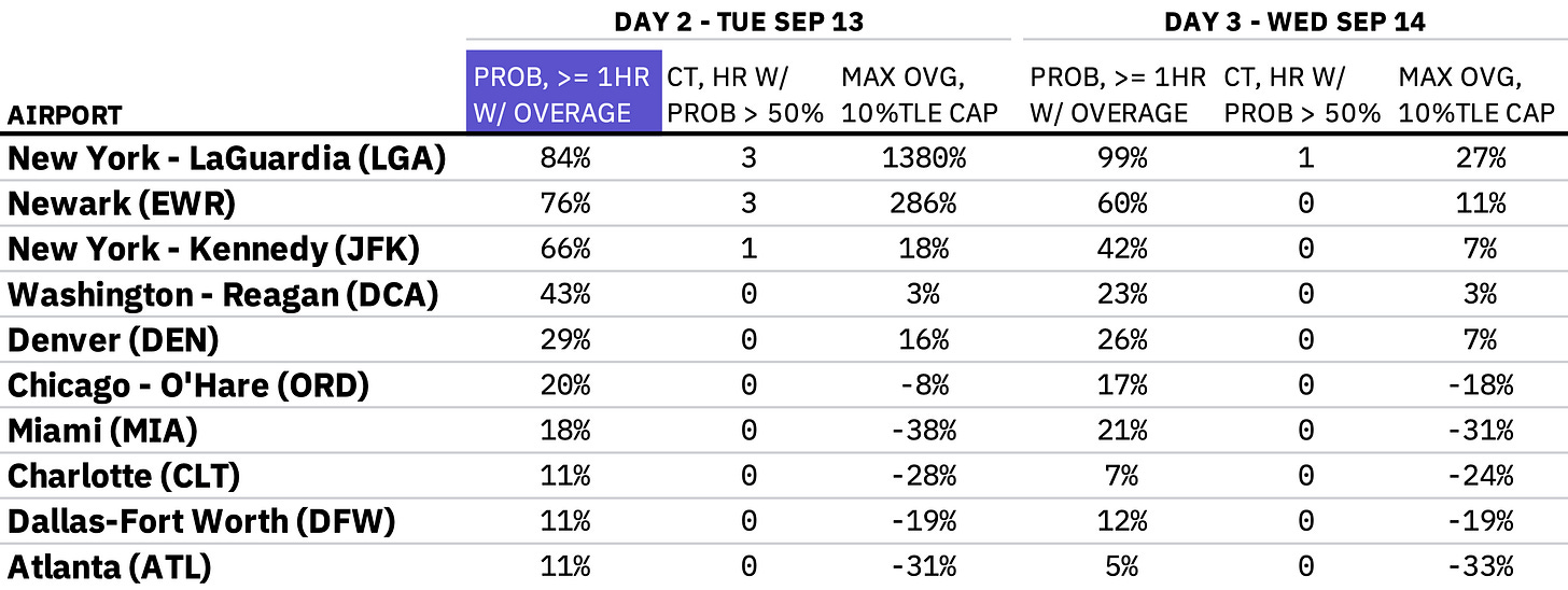
Cold front crawls across NYC on Tuesday, remnants from Kay may compound radar outage for DEN on Wednesday
Welcome to any new readers! And as a reminder to long-ish time readers, we’re testing a new format for these outlooks. To both old and new—we’re grateful you’re here.
If you have questions about the content of this outlook, the answers might be in this post (we keep adding to it). Otherwise, let us know if something doesn’t make sense (we welcome feedback of all kinds!).
Tuesday, September 13
We forecast TSA will screen 1.922 million travelers (± 0.5σ, or a prediction interval of about 38%, is 1.86-1.98 million travelers).
Low pressure drifting across southern Ontario will push a cold front through the NYC area. Rain tapers off through afternoon, though thunderstorm chances will diminish across the morning.
Wednesday, September 14
We forecast TSA will screen 1.934 million travelers (± 0.5σ, or a prediction interval of about 38%, is 1.87-2.00 million travelers).
Remnants from once-Hurricane Kay will arrive in the Central Rockies. Associated rainfall will push off the high terrain but decrease in coverage as it reaches the urban corridor around DEN. Note: our overage probabilities for DEN may be underdone on account of a nearby radar outage.
You can check out1 hourly estimates in this workbook.
While it links to a Google Sheet, it’s an Excel file and relies on the XLOOKUP function, which does not exist in Sheets. You can download the file and open in Excel, which should resolve the #NAME? error; if any readers don’t have Excel, let us know and we can work on a solution.


