Wednesday, Aug. 17 & Thursday, Aug. 18 Outlook
Evening storms associated with cold front expected for DFW on Wednesday
Welcome to any new readers! And as a reminder to long-ish time readers, we’re testing a new format for these outlooks. To both old and new—we’re grateful you’re here.
If you have questions about the content of this outlook, the answers might be in this post. Otherwise, let us know if something doesn’t make sense (we welcome feedback of all kinds!).
We’ve added a third column to our table—we think it helps to provide a fuller picture of risk (wherein risk is a function of likelihood and consequence). The first two [original] columns are intended to communicate information about the chance of an arrival demand overage (and therefore delays):
Probability that an overage occurs in at least one hour reflects the cumulative likelihood across the entire1 day. In a binary sense, it answers the question is disruption likely at that airport on that day?
Count of hours where an overage is more likely than not answers the question, is any capacity/demand imbalance widespread or more isolated?
If the first two columns are meant to communicate how likely, then the newly-added maximum overage, given capacity in the 10th percentile is meant communicate how bad. More specifically, it considers scheduled arrival demand as a percentage of a reasonable worst-case capacity. A relatively short overage (10% or less) might be resolvable with a largely imperceptible form of traffic management (e.g. metering) or perhaps a brief, first-tier ground stop; a taller overage likely requires a weightier initiative (e.g. ground delay program). A negative number indicates that demand falls short of even 10th percentile capacity.
Wednesday, August 17
We forecast TSA will screen 2.098 million travelers (± 0.5σ, or a prediction interval of about 38%, is 2.03-2.16 million travelers).
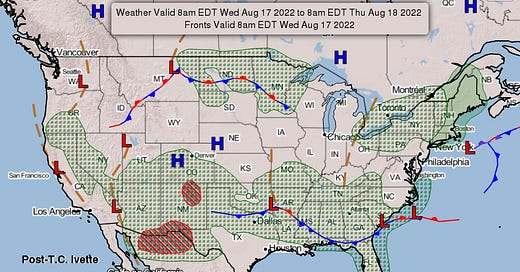
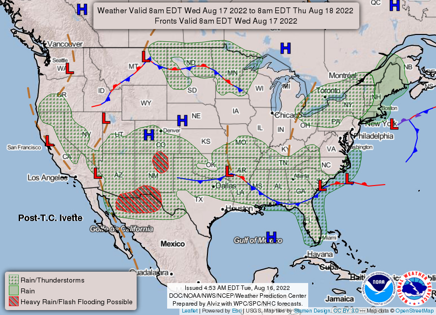
You guessed it… monsoonal moisture will continue to promote showers and thunderstorms from the central Rockies down into the Southwest. (If you’re wondering when we’ll stop writing about it, so are we—but above normal probabilities for precipitation2 persist into September for the region.) Elsewhere, a weak front extending from the Central Plains to Southeast will produce showers and thunderstorms; for DFW specifically, thunderstorm chances approach 30% during the evening. Finally, coastal low pressure looks to pass to the east of the NYC area before retrograding westward.
Thursday, August 18
We forecast TSA will screen 2.312 million travelers (± 0.5σ, or a prediction interval of about 38%, is 2.25-2.38 million travelers).
Low pressure over southwestern Texas will meander westward, transporting even deeper moisture into the Southwest. The weak front across the Great Plains and Southeast will slowly sag southward, allowing it to tap tropical moisture for shower and thunderstorm production.
You can check out3 hourly estimates in this workbook.
We’re using 10:00 through 06:00 GMT, which covers 06:00 EDT through 22:00 PST.
While it links to a Google Sheet, it’s an Excel file and relies the XLOOKUP function, which does not exist in Sheets. You can download the file and open in Excel, which should resolve the #NAME? error; if any readers don’t have Excel, let us know and we can work on a solution.


